Distance between Coimbatore and Airport
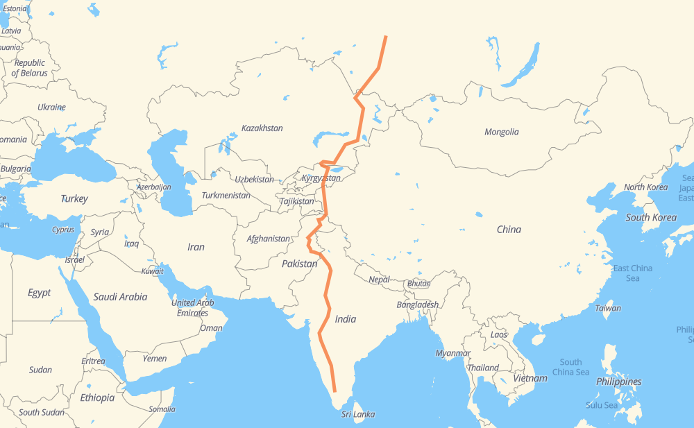
The distance from Coimbatore to Airport is 4,522 miles by road including 368 miles on motorways. Road takes approximately 86 hours and 27 minutes and goes through Mysuru, Vijayapura, Ahmadnagar, Malegaon, Dhule, Indore and Ujjain.
| Shortest distance by air | 3,168 mi ✈️ |
| Car route length | 4,522.3 mi 🚗 |
| Driving time | 86 h 27 min |
| Fuel amount | 153.8 gal |
| Fuel cost | 604.5 USD |
| Point | Distance | Time | Fuel | |
| Coimbatore | 0 mi | 00 min | 0.0 gal | |
|
NH948 NH181 140 mi, 2 h 50 min
|
||||
| Mysuru | 140 mi | 2 h 50 min | 4.7 gal | |
|
NH50 354 mi, 7 h 06 min
|
||||
| Vijayapura | 493 mi | 9 h 57 min | 16.6 gal | |
|
NH50 NH561A 186 mi, 3 h 36 min
|
||||
| Ahmadnagar | 679 mi | 13 h 33 min | 23.1 gal | |
|
NH561A NH160 112 mi, 2 h 09 min
|
||||
| Malegaon | 792 mi | 15 h 43 min | 26.8 gal | |
|
NH60 29 mi, 33 min
|
||||
| Dhule | 820 mi | 16 h 17 min | 27.7 gal | |
|
NH60 NH52 165 mi, 3 h 14 min
|
||||
| Indore | 986 mi | 19 h 32 min | 33.4 gal | |
|
SH59 45 mi, 51 min
|
||||
| Ujjain | 1,031 mi | 20 h 23 min | 34.5 gal | |
|
NH552G 149 mi, 2 h 53 min
|
||||
| Kota | 1,180 mi | 23 h 17 min | 40.0 gal | |
|
NH52 314 mi, 5 h 59 min
|
||||
| Bhiwani | 1,494 mi | 29 h 17 min | 50.7 gal | |
|
NH148B NH709A 41 mi, 46 min
|
||||
| Jind | 1,535 mi | 30 h 03 min | 52.1 gal | |
|
NH709A NH52 253 mi, 4 h 54 min
|
||||
| Sheikhupura | 1,788 mi | 34 h 58 min | 60.7 gal | |
|
M-2 255 mi, 3 h 45 min
|
||||
| Abbottabad | 2,043 mi | 38 h 44 min | 69.4 gal | |
|
M-15 27 mi, 27 min
|
||||
| Mansehra | 2,071 mi | 39 h 12 min | 70.1 gal | |
|
N-15 N-35 454 mi, 8 h 55 min
|
||||
| Tashkurgan | 2,525 mi | 48 h 08 min | 85.6 gal | |
|
G314 396 mi, 7 h 23 min
|
||||
| Naryn | 2,921 mi | 55 h 31 min | 99.3 gal | |
|
ЭМ-07 319 mi, 5 h 56 min
|
||||
| Almaty | 3,240 mi | 61 h 27 min | 109.9 gal | |
|
A-2 A-3 157 mi, 2 h 49 min
|
||||
| Taldykorgan | 3,398 mi | 64 h 17 min | 115.5 gal | |
|
A-3 541 mi, 10 h 21 min
|
||||
| Semipalatinsk | 3,939 mi | 74 h 38 min | 133.6 gal | |
|
A-11 96 mi, 1 h 56 min
|
||||
| Rubtsovsk | 4,035 mi | 76 h 35 min | 137.0 gal | |
|
А-322 181 mi, 3 h 42 min
|
||||
| Barnaul | 4,215 mi | 80 h 17 min | 143.2 gal | |
|
01К-01 Р-256 121 mi, 2 h 17 min
|
||||
| Berdsk | 4,336 mi | 82 h 35 min | 147.4 gal | |
|
Р-256 17 mi, 25 min
|
||||
| Novosibirsk | 4,353 mi | 83 h 00 min | 147.6 gal | |
|
Р-256 Р-255 163 mi, 3 h 05 min
|
||||
| Tomsk | 4,516 mi | 86 h 05 min | 153.5 gal | |
|
Р-255 69А-1 13 mi, 21 min
|
||||
| Airport | 4,529 mi | 86 h 26 min | 154.0 gal | |
Hotels of Airport
Frequently Asked Questions
How much does it cost to drive from Coimbatore to Airport?
Fuel cost: 604.5 USD
This fuel cost is calculated as: (Route length 4,522.3 mi) / (Fuel consumption 29.4 mpg) * (Fuel price 3.93 USD / gal)
You can adjust fuel consumption and fuel price here.
How long is a car ride from Coimbatore to Airport?
Driving time: 86 h 27 min
This time is calculated for driving at the maximum permitted speed, taking into account traffic rules restrictions.
- 324 mi with a maximum speed 68 mph = 4 h 46 min
- 37 mi with a maximum speed 62 mph = 36 min
- 1,264 mi with a maximum speed 56 mph = 22 h 34 min
- 646 mi with a maximum speed 56 mph = 11 h 32 min
- 2,063 mi with a maximum speed 50 mph = 41 h 30 min
- 29 mi with a maximum speed 43 mph = 39 min
- 140 mi with a maximum speed 37 mph = 3 h 45 min
- 17 mi with a maximum speed 31 mph = 33 min
- 3 mi with a maximum speed 25 mph = 6 min
- 2 mi with a maximum speed 22 mph = 5 min
- 4 mi with a maximum speed 19 mph = 12 min
- 1 mi with a maximum speed 12 mph = 6 min
The calculated driving time does not take into account intermediate stops and traffic jams.
How far is Coimbatore to Airport by land?
The distance between Coimbatore and Airport is 4,522.3 mi by road including 367.9 mi on motorways.
Precise satellite coordinates of highways were used for this calculation. The start and finish points are the centers of Coimbatore and Airport respectively.
How far is Coimbatore to Airport by plane?
The shortest distance (air line, as the crow flies) between Coimbatore and Airport is 3,167.8 mi.
This distance is calculated using the Haversine formula as a great-circle distance between two points on the surface of a sphere. The start and finish points are the centers of Coimbatore and Airport respectively. Actual distance between airports may be different.
How many hours is Coimbatore from Airport by plane?
Boeing 737 airliner needs 6 h 22 min to cover the distance of 3,168 mi at a cruising speed of 497 mph.
Small plane "Cessna 172" needs 23 h 10 min to flight this distance at average speed of 136 mph.
This time is approximate and do not take into account takeoff and landing times, airport location and other real world factors.
How long is a helicopter ride from Coimbatore to Airport?
Fast helicopter "Eurocopter AS350" or "Hughes OH-6 Cayuse" need 21 h 14 min to cover the distance of 3,168 mi at a cruising speed of 149 mph.
Popular "Robinson R44" needs 24 h 16 min to flight this distance at average speed of 130 mph.
This time is approximate and do not take into account takeoff and landing times, aerodrome location and other real world factors.
What city is halfway between Coimbatore and Airport?
The halfway point between Coimbatore and Airport is Minawar. It is located about 7 mi from the exact midpoint by road.
The distance from Minawar to Coimbatore is 2,268 mi and driving will take about 42 h 58 min. The road between Minawar and Airport has length 2,254 mi and will take approximately 43 h 28 min.
The other cities located close to halfway point:
Where is Coimbatore in relation to Airport?
Coimbatore is located 3,168 mi south of Airport.
Coimbatore has geographic coordinates: latitude 11.00181, longitude 76.96284.
Airport has geographic coordinates: latitude 56.38934, longitude 85.20524.
Which highway goes from Coimbatore to Airport?
The route from Coimbatore to Airport follows A-3, NH52, ЭМ-07, G314, N-35, А-322, M-2, NH50, NH561A, N-15, Р-255, A-2, NH150A, Р-256, NH552G, M-38, NH48, NH148B, A-11, S212.
Other minor sections pass along the road:
- NH181: 55 mi
- M-15: 54 mi
- NH160: 53 mi
- NH703: 45 mi
- NH703B: 45 mi
- NH709A: 40 mi
- NH766: 33 mi
- NH752G: 33 mi
- NH60: 31 mi
- SH59: 30 mi
- M-1: 24 mi
- NH248: 22 mi
- G3013: 22 mi
- SH10: 21 mi
- NH352: 20 mi
- NH7: 19 mi
- 347B: 18 mi
- NH948: 16 mi
- 347C: 12 mi
- SH14: 12 mi
- P-47: 11 mi
- 69А-1: 11 mi
- SH17: 11 mi
- 01К-01: 9 mi
- M11: 9 mi
- N-5: 8 mi
- MDR61: 7 mi
- G3012: 6 mi
- 148D: 6 mi
- 150A: 6 mi
- SH80: 6 mi
- NH54: 6 mi
- NH148B (SH 14): 5 mi
- NH275: 5 mi
- SH168: 4 mi
- 561A: 4 mi
- NH47: 4 mi
- NH67: 4 mi
- NH65: 4 mi
- SH16: 4 mi
- 148B: 3 mi
- NH61: 3 mi
- ODR29: 3 mi
- 160: 2 mi
- L-20: 2 mi
- 275: 2 mi
- 60: 2 mi
- 52: 2 mi
- 703B: 2 mi
- M-026: 2 mi
- NH703A: 1 mi
- SH141: 1 mi
- SH13: 1 mi
- NH334B: 1 mi
- G581: 1 mi
- A-349: 1 mi
- 352: 1 mi
- NH152: 1 mi
- NH69: 1 mi
- NH347B: 1 mi
- 67: 1 mi
- SH64: 1 mi
- 753F: 1 mi