Distance between Jowai and Ahore
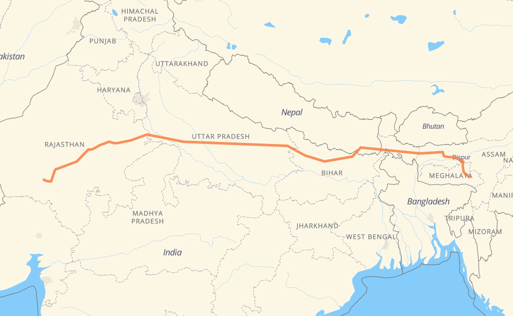
The distance from Jowai to Ahore is 1,481 miles by road including 189 miles on motorways. Road takes approximately 27 hours and 41 minutes and goes through Shillong, Darbhanga, Gorakhpur, Chhawani, Barabanki, Agra and Bharatpur.
| Shortest distance by air | 1,211 mi ✈️ |
| Car route length | 1,481.3 mi 🚗 |
| Driving time | 27 h 41 min |
| Fuel amount | 50.4 gal |
| Fuel cost | 198 USD |
| Point | Distance | Time | Fuel | |
| Jowai | 0 mi | 00 min | 0.0 gal | |
|
NH6 14 mi, 16 min
|
||||
| Shillong | 14 mi | 16 min | 0.3 gal | |
|
NH6 NH27 526 mi, 9 h 56 min
|
||||
| Darbhanga | 539 mi | 10 h 13 min | 18.2 gal | |
|
NH27 181 mi, 3 h 28 min
|
||||
| Gorakhpur | 721 mi | 13 h 41 min | 24.4 gal | |
|
NH24 NH27 66 mi, 1 h 13 min
|
||||
| Chhawani | 787 mi | 14 h 54 min | 26.7 gal | |
|
NH27 83 mi, 1 h 32 min
|
||||
| Barabanki | 870 mi | 16 h 27 min | 29.5 gal | |
|
NH27 221 mi, 3 h 39 min
|
||||
| Agra | 1,091 mi | 20 h 07 min | 37.0 gal | |
|
MDR113W NH21 34 mi, 39 min
|
||||
| Bharatpur | 1,125 mi | 20 h 47 min | 38.1 gal | |
|
NH21 112 mi, 2 h 13 min
|
||||
| Jaipur | 1,237 mi | 23 h 00 min | 42.0 gal | |
|
NH48 117 mi, 2 h 13 min
|
||||
| Beawar | 1,354 mi | 25 h 13 min | 45.9 gal | |
|
NH158 NH162 127 mi, 2 h 28 min
|
||||
| Ahore | 1,481 mi | 27 h 41 min | 50.4 gal | |
Hotels of Ahore
Frequently Asked Questions
How much does it cost to drive from Jowai to Ahore?
Fuel cost: 198 USD
This fuel cost is calculated as: (Route length 1,481.3 mi) / (Fuel consumption 29.4 mpg) * (Fuel price 3.93 USD / gal)
You can adjust fuel consumption and fuel price here.
How long is a car ride from Jowai to Ahore?
Driving time: 27 h 41 min
This time is calculated for driving at the maximum permitted speed, taking into account traffic rules restrictions.
- 189 mi with a maximum speed 62 mph = 3 h 2 min
- 608 mi with a maximum speed 56 mph = 10 h 51 min
- 681 mi with a maximum speed 50 mph = 13 h 41 min
- 2 mi with a maximum speed 37 mph = 3 min
- 1 mi with a maximum speed 31 mph = 2 min
The calculated driving time does not take into account intermediate stops and traffic jams.
How far is Jowai to Ahore by land?
The distance between Jowai and Ahore is 1,481.3 mi by road including 188.9 mi on motorways.
Precise satellite coordinates of highways were used for this calculation. The start and finish points are the centers of Jowai and Ahore respectively.
How far is Jowai to Ahore by plane?
The shortest distance (air line, as the crow flies) between Jowai and Ahore is 1,211.1 mi.
This distance is calculated using the Haversine formula as a great-circle distance between two points on the surface of a sphere. The start and finish points are the centers of Jowai and Ahore respectively. Actual distance between airports may be different.
How many hours is Jowai from Ahore by plane?
Boeing 737 airliner needs 2 h 26 min to cover the distance of 1,211 mi at a cruising speed of 497 mph.
Small plane "Cessna 172" needs 8 h 51 min to flight this distance at average speed of 136 mph.
This time is approximate and do not take into account takeoff and landing times, airport location and other real world factors.
How long is a helicopter ride from Jowai to Ahore?
Fast helicopter "Eurocopter AS350" or "Hughes OH-6 Cayuse" need 8 h 7 min to cover the distance of 1,211 mi at a cruising speed of 149 mph.
Popular "Robinson R44" needs 9 h 16 min to flight this distance at average speed of 130 mph.
This time is approximate and do not take into account takeoff and landing times, aerodrome location and other real world factors.
What city is halfway between Jowai and Ahore?
The halfway point between Jowai and Ahore is Khalilabad. It is located about 1 mi from the exact midpoint by road.
The distance from Khalilabad to Jowai is 741 mi and driving will take about 14 h 3 min. The road between Khalilabad and Ahore has length 740 mi and will take approximately 13 h 38 min.
The other cities located close to halfway point:
Where is Jowai in relation to Ahore?
Jowai is located 1,211 mi east of Ahore.
Jowai has geographic coordinates: latitude 25.44174, longitude 92.19501.
Ahore has geographic coordinates: latitude 25.36825, longitude 72.78099.
Which highway goes from Jowai to Ahore?
The route from Jowai to Ahore follows NH27, NH21, H01.
Other minor sections pass along the road:
- NH427: 57 mi
- NH162: 57 mi
- NH48: 56 mi
- NH6: 55 mi
- NH62: 32 mi
- Shillong Bypass: 30 mi
- NH58: 29 mi
- NH325: 25 mi
- NH448: 22 mi
- NH131: 17 mi
- MDR: 14 mi
- NH17: 12 mi
- NH327: 11 mi
- NH25: 10 mi
- 27: 9 mi
- NH330: 7 mi
- 458: 6 mi
- 248: 5 mi
- SH74: 4 mi
- SH40: 4 mi
- SH62: 4 mi
- NH57: 4 mi
- NH37: 2 mi
- NH158: 2 mi
- NH24: 1 mi
- MDR113W: 1 mi
- NH44: 1 mi
- NH30: 1 mi
- 28: 1 mi