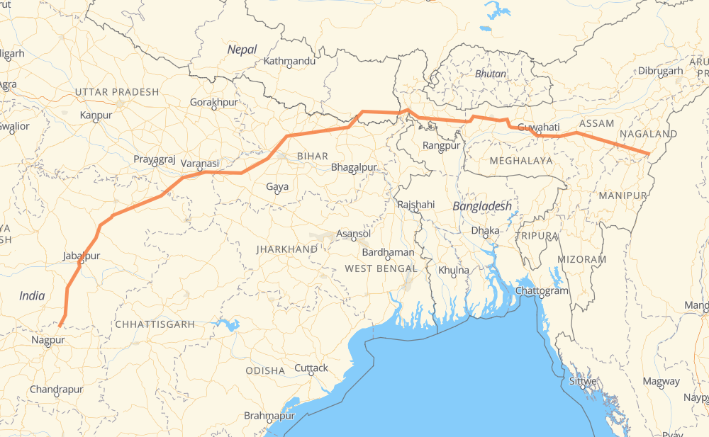
The distance from Meluri to Devlapar is 1,365 miles by road. Road takes approximately 26 hours and 5 minutes and goes through Darbhanga, Muzaffarpur, Arrah, Rewa and Jabalpur.
You can adjust fuel consumption and fuel price here.
How long is a car ride from Meluri to Devlapar?
Driving time:
26 h 5 min
This time is calculated for driving at the maximum permitted speed, taking into account traffic rules restrictions.
733 mi with a maximum speed 56 mph = 13 h 5 min
634 mi with a maximum speed 50 mph = 12 h 44 min
2 mi with a maximum speed 31 mph = 4 min
4 mi with a maximum speed 25 mph = 10 min
The calculated driving time does not take into account intermediate stops and traffic jams.
How far is Meluri to Devlapar by land?
The distance between Meluri and Devlapar is 1,365.2 mi by road.
Precise satellite coordinates of highways were used for this calculation. The start and finish points are the centers of Meluri and Devlapar respectively.
How far is Meluri to Devlapar by plane?
The shortest distance (air line, as the crow flies) between Meluri and Devlapar is 1,006 mi.
This distance is calculated using the Haversine formula as a great-circle distance between two points on the surface of a sphere. The start and finish points are the centers of Meluri and Devlapar respectively. Actual distance between airports may be different.
How many hours is Meluri from Devlapar by plane?
Boeing 737 airliner needs 2 h 1 min to cover the distance of 1,006 mi at a cruising speed of 497 mph.
Small plane "Cessna 172" needs 7 h 21 min to flight this distance at average speed of 136 mph.
This time is approximate and do not take into account takeoff and landing times, airport location and other real world factors.
How long is a helicopter ride from Meluri to Devlapar?
Fast helicopter "Eurocopter AS350" or "Hughes OH-6 Cayuse" need 6 h 44 min to cover the distance of 1,006 mi at a cruising speed of 149 mph.
Popular "Robinson R44" needs 7 h 42 min to flight this distance at average speed of 130 mph.
This time is approximate and do not take into account takeoff and landing times, aerodrome location and other real world factors.
What city is halfway between Meluri and Devlapar?
The halfway point between Meluri and Devlapar is Simrahi.
The distance from Simrahi to Meluri is 683 mi and driving will take about 13 h 3 min. The road between Simrahi and Devlapar has length 682 mi and will take approximately 13 h 2 min.
The other cities located close to halfway point:
Ratanpura is in 674 mi from Meluri and 691 mi from Devlapar
Bhimnagar is in 665 mi from Meluri and 700 mi from Devlapar
Narahia is in 706 mi from Meluri and 659 mi from Devlapar
Where is Meluri in relation to Devlapar?
Meluri is located 1,006 mi north-east of Devlapar.
Meluri has geographic coordinates: latitude 25.68445, longitude 94.62848.
Devlapar has geographic coordinates: latitude 21.58693, longitude 79.36921.
Which highway goes from Meluri to Devlapar?
The route from Meluri to Devlapar follows NH27, NH29, NH30, H01, NH135, NH44, NH319.