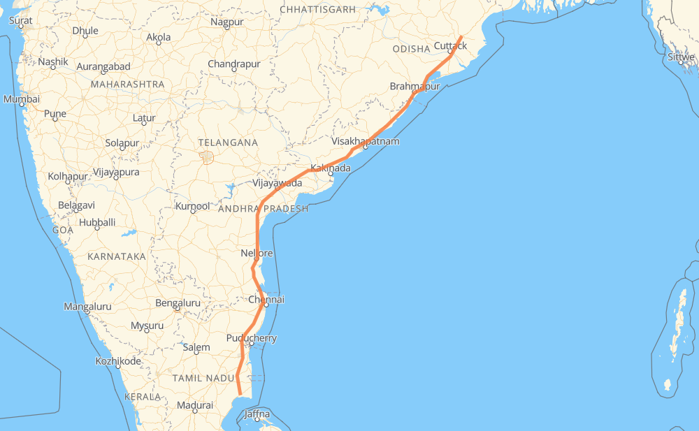
The distance from Muthupet to Alatiri is 1,027 miles by road including 47 miles on motorways. Road takes approximately 20 hours and 39 minutes and goes through Nellore, Guntur, Vijayawada, Eluru, Bhubaneswar and Cuttack.
You can adjust fuel consumption and fuel price here.
How long is a car ride from Muthupet to Alatiri?
Driving time:
20 h 39 min
This time is calculated for driving at the maximum permitted speed, taking into account traffic rules restrictions.
21 mi with a maximum speed 62 mph = 20 min
237 mi with a maximum speed 56 mph = 4 h 13 min
728 mi with a maximum speed 50 mph = 14 h 38 min
25 mi with a maximum speed 37 mph = 41 min
1 mi with a maximum speed 31 mph = 2 min
18 mi with a maximum speed 25 mph = 43 min
The calculated driving time does not take into account intermediate stops and traffic jams.
How far is Muthupet to Alatiri by land?
The distance between Muthupet and Alatiri is 1,027.1 mi by road including 46.6 mi on motorways.
Precise satellite coordinates of highways were used for this calculation. The start and finish points are the centers of Muthupet and Alatiri respectively.
How far is Muthupet to Alatiri by plane?
The shortest distance (air line, as the crow flies) between Muthupet and Alatiri is 853.1 mi.
This distance is calculated using the Haversine formula as a great-circle distance between two points on the surface of a sphere. The start and finish points are the centers of Muthupet and Alatiri respectively. Actual distance between airports may be different.
How many hours is Muthupet from Alatiri by plane?
Boeing 737 airliner needs 1 h 42 min to cover the distance of 853 mi at a cruising speed of 497 mph.
Small plane "Cessna 172" needs 6 h 14 min to flight this distance at average speed of 136 mph.
This time is approximate and do not take into account takeoff and landing times, airport location and other real world factors.
How long is a helicopter ride from Muthupet to Alatiri?
Fast helicopter "Eurocopter AS350" or "Hughes OH-6 Cayuse" need 5 h 43 min to cover the distance of 853 mi at a cruising speed of 149 mph.
Popular "Robinson R44" needs 6 h 32 min to flight this distance at average speed of 130 mph.
This time is approximate and do not take into account takeoff and landing times, aerodrome location and other real world factors.
What city is halfway between Muthupet and Alatiri?
The halfway point between Muthupet and Alatiri is Telaprolu. It is located about 1 mi from the exact midpoint by road.
The distance from Telaprolu to Muthupet is 514 mi and driving will take about 10 h 27 min. The road between Telaprolu and Alatiri has length 513 mi and will take approximately 10 h 11 min.
The other cities located close to halfway point:
Pedda Avutapalle is in 525 mi from Muthupet and 502 mi from Alatiri
Eluru is in 532 mi from Muthupet and 495 mi from Alatiri
Vijayawada is in 495 mi from Muthupet and 533 mi from Alatiri
Where is Muthupet in relation to Alatiri?
Muthupet is located 853 mi south-west of Alatiri.
Muthupet has geographic coordinates: latitude 10.39569, longitude 79.49447.
Alatiri has geographic coordinates: latitude 20.90675, longitude 86.23097.
Which highway goes from Muthupet to Alatiri?
The route from Muthupet to Alatiri follows NH16, NH36.