Distance between Pahalgām and Mulabagilu
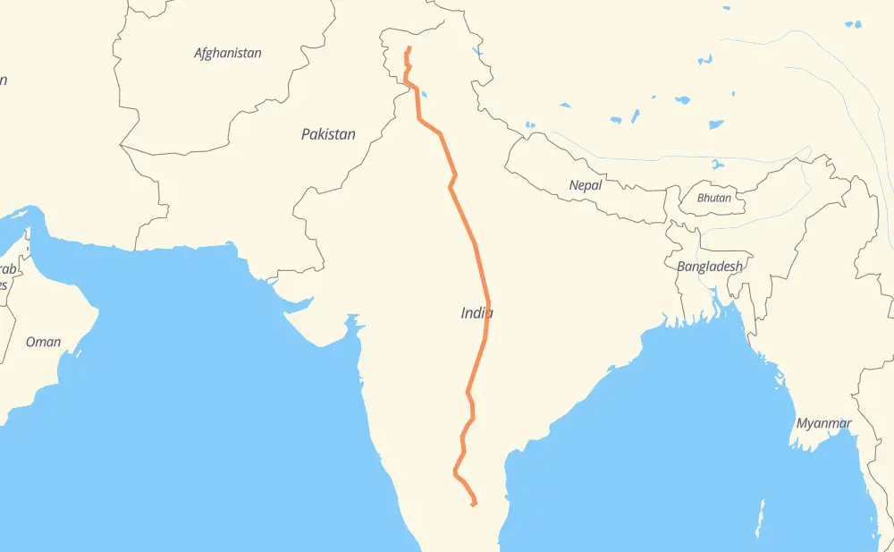
The distance from Pahalgām to Mulabagilu is 1,821 miles by road including 93 miles on motorways. Road takes approximately 35 hours and 16 minutes and goes through Jalandhar, Ludhiana, Ambala, Karnal, Panipat, Mathura and Gwalior.
| Shortest distance by air | 1,456 mi ✈️ |
| Car route length | 1,820.6 mi 🚗 |
| Driving time | 35 h 16 min |
| Fuel amount | 61.9 gal |
| Fuel cost | 243.4 USD |
| Point | Distance | Time | Fuel | |
| Pahalgām | 0 mi | 00 min | 0.0 gal | |
|
NH501 NH44 260 mi, 5 h 33 min
|
||||
| Jalandhar | 260 mi | 5 h 33 min | 8.7 gal | |
|
NH44 42 mi, 46 min
|
||||
| Ludhiana | 302 mi | 6 h 20 min | 10.2 gal | |
|
NH44 65 mi, 1 h 15 min
|
||||
| Ambala | 367 mi | 7 h 35 min | 12.4 gal | |
|
NH44 53 mi, 1 h 01 min
|
||||
| Karnal | 421 mi | 8 h 37 min | 14.2 gal | |
|
NH44 21 mi, 24 min
|
||||
| Panipat | 441 mi | 9 h 01 min | 14.9 gal | |
|
NH44 170 mi, 2 h 59 min
|
||||
| Mathura | 611 mi | 12 h 01 min | 20.6 gal | |
|
NH44 109 mi, 2 h 13 min
|
||||
| Gwalior | 720 mi | 14 h 15 min | 24.3 gal | |
|
NH44 60 mi, 1 h 07 min
|
||||
| Jhansi | 780 mi | 15 h 22 min | 26.4 gal | |
|
NH44 126 mi, 2 h 21 min
|
||||
| Sagar | 905 mi | 17 h 43 min | 30.6 gal | |
|
SH21 NH547 256 mi, 4 h 48 min
|
||||
| Nagpur | 1,161 mi | 22 h 32 min | 39.5 gal | |
|
NH47 NH44 437 mi, 8 h 10 min
|
||||
| Kurnool | 1,599 mi | 30 h 43 min | 54.3 gal | |
|
NH44 91 mi, 1 h 42 min
|
||||
| Anantapur | 1,690 mi | 32 h 25 min | 57.4 gal | |
|
NH42 147 mi, 2 h 50 min
|
||||
| Mulabagilu | 1,837 mi | 35 h 16 min | 62.5 gal | |
Frequently Asked Questions
How much does it cost to drive from Pahalgām to Mulabagilu?
Fuel cost: 243.4 USD
This fuel cost is calculated as: (Route length 1,820.6 mi) / (Fuel consumption 29.4 mpg) * (Fuel price 3.93 USD / gal)
You can adjust fuel consumption and fuel price here.
How long is a car ride from Pahalgām to Mulabagilu?
Driving time: 35 h 16 min
This time is calculated for driving at the maximum permitted speed, taking into account traffic rules restrictions.
- 70 mi with a maximum speed 68 mph = 1 h 1 min
- 2 mi with a maximum speed 62 mph = 1 min
- 812 mi with a maximum speed 56 mph = 14 h 29 min
- 71 mi with a maximum speed 56 mph = 1 h 16 min
- 764 mi with a maximum speed 50 mph = 15 h 21 min
- 43 mi with a maximum speed 43 mph = 59 min
- 69 mi with a maximum speed 37 mph = 1 h 51 min
- 7 mi with a maximum speed 31 mph = 12 min
- 1 mi with a maximum speed 25 mph = 1 min
The calculated driving time does not take into account intermediate stops and traffic jams.
How far is Pahalgām to Mulabagilu by land?
The distance between Pahalgām and Mulabagilu is 1,820.6 mi by road including 93.2 mi on motorways.
Precise satellite coordinates of highways were used for this calculation. The start and finish points are the centers of Pahalgām and Mulabagilu respectively.
How far is Pahalgām to Mulabagilu by plane?
The shortest distance (air line, as the crow flies) between Pahalgām and Mulabagilu is 1,455.9 mi.
This distance is calculated using the Haversine formula as a great-circle distance between two points on the surface of a sphere. The start and finish points are the centers of Pahalgām and Mulabagilu respectively. Actual distance between airports may be different.
How many hours is Pahalgām from Mulabagilu by plane?
Boeing 737 airliner needs 2 h 55 min to cover the distance of 1,456 mi at a cruising speed of 497 mph.
Small plane "Cessna 172" needs 10 h 39 min to flight this distance at average speed of 136 mph.
This time is approximate and do not take into account takeoff and landing times, airport location and other real world factors.
How long is a helicopter ride from Pahalgām to Mulabagilu?
Fast helicopter "Eurocopter AS350" or "Hughes OH-6 Cayuse" need 9 h 45 min to cover the distance of 1,456 mi at a cruising speed of 149 mph.
Popular "Robinson R44" needs 11 h 9 min to flight this distance at average speed of 130 mph.
This time is approximate and do not take into account takeoff and landing times, aerodrome location and other real world factors.
What city is halfway between Pahalgām and Mulabagilu?
The halfway point between Pahalgām and Mulabagilu is Sagar. It is located about 5 mi from the exact midpoint by road.
The distance from Sagar to Pahalgām is 905 mi and driving will take about 17 h 42 min. The road between Sagar and Mulabagilu has length 915 mi and will take approximately 17 h 33 min.
The other cities located close to halfway point:
Where is Pahalgām in relation to Mulabagilu?
Pahalgām is located 1,456 mi north of Mulabagilu.
Pahalgām has geographic coordinates: latitude 34.03889, longitude 75.32286.
Mulabagilu has geographic coordinates: latitude 13.1626, longitude 78.3959.
Which highway goes from Pahalgām to Mulabagilu?
The route from Pahalgām to Mulabagilu follows NH44, NH547, NH42, NE2.
Other minor sections pass along the road:
- SH: 40 mi
- NH47: 32 mi
- NH501: 26 mi
- NH123: 13 mi
- Old NH7: 11 mi
- 347A: 11 mi
- NH321: 9 mi
- SH42: 7 mi
- NE-2: 7 mi
- NH46: 6 mi
- MDR127W: 6 mi
- SH21: 5 mi
- 44: 4 mi
- NH146: 4 mi
- NH69: 4 mi
- NH3: 3 mi
- NH21: 2 mi
- SH58: 1 mi
- NH53: 1 mi
- NH7: 1 mi
- NH65: 1 mi
- NH163: 1 mi
- NH152: 1 mi