Distance between Vadodara and Airport
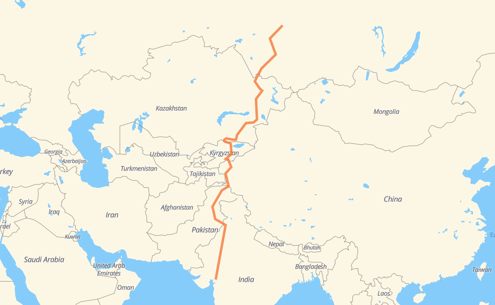
The distance from Vadodara to Airport is 3,606 miles by road including 368 miles on motorways. Road takes approximately 68 hours and 13 minutes and goes through Udaipur, Beawar, Bikaner, Sri Ganganagar, Sheikhupura, Abbottabad and Mansehra.
| Shortest distance by air | 2,435 mi ✈️ |
| Car route length | 3,606.4 mi 🚗 |
| Driving time | 68 h 13 min |
| Fuel amount | 122.7 gal |
| Fuel cost | 478.4 USD |
| Point | Distance | Time | Fuel | |
| Vadodara | 0 mi | 00 min | 0.0 gal | |
|
NH48 190 mi, 3 h 32 min
|
||||
| Udaipur | 190 mi | 3 h 32 min | 6.4 gal | |
|
NH48 NH58 141 mi, 2 h 45 min
|
||||
| Beawar | 331 mi | 6 h 17 min | 10.9 gal | |
|
NH158 NH62 164 mi, 3 h 16 min
|
||||
| Bikaner | 495 mi | 9 h 34 min | 16.7 gal | |
|
NH89 NH62 149 mi, 2 h 54 min
|
||||
| Sri Ganganagar | 644 mi | 12 h 29 min | 21.7 gal | |
|
NH911 NH354 221 mi, 4 h 16 min
|
||||
| Sheikhupura | 864 mi | 16 h 45 min | 29.3 gal | |
|
M-2 255 mi, 3 h 45 min
|
||||
| Abbottabad | 1,120 mi | 20 h 31 min | 38.0 gal | |
|
M-15 27 mi, 27 min
|
||||
| Mansehra | 1,148 mi | 20 h 58 min | 38.7 gal | |
|
N-15 N-35 454 mi, 8 h 55 min
|
||||
| Tashkurgan | 1,602 mi | 29 h 54 min | 54.2 gal | |
|
G314 396 mi, 7 h 23 min
|
||||
| Naryn | 1,998 mi | 37 h 18 min | 67.9 gal | |
|
ЭМ-07 319 mi, 5 h 56 min
|
||||
| Almaty | 2,317 mi | 43 h 14 min | 78.5 gal | |
|
A-2 A-3 157 mi, 2 h 49 min
|
||||
| Taldykorgan | 2,474 mi | 46 h 03 min | 84.1 gal | |
|
A-3 541 mi, 10 h 21 min
|
||||
| Semipalatinsk | 3,016 mi | 56 h 24 min | 102.2 gal | |
|
A-11 96 mi, 1 h 56 min
|
||||
| Rubtsovsk | 3,111 mi | 58 h 21 min | 105.6 gal | |
|
А-322 181 mi, 3 h 42 min
|
||||
| Barnaul | 3,292 mi | 62 h 04 min | 111.8 gal | |
|
01К-01 Р-256 121 mi, 2 h 17 min
|
||||
| Berdsk | 3,413 mi | 64 h 21 min | 116.0 gal | |
|
Р-256 17 mi, 25 min
|
||||
| Novosibirsk | 3,429 mi | 64 h 47 min | 116.2 gal | |
|
Р-256 Р-255 163 mi, 3 h 05 min
|
||||
| Tomsk | 3,593 mi | 67 h 52 min | 122.1 gal | |
|
Р-255 69А-1 13 mi, 21 min
|
||||
| Airport | 3,606 mi | 68 h 13 min | 122.6 gal | |
Hotels of Airport
Frequently Asked Questions
How much does it cost to drive from Vadodara to Airport?
Fuel cost: 478.4 USD
This fuel cost is calculated as: (Route length 3,606.4 mi) / (Fuel consumption 29.4 mpg) * (Fuel price 3.9 USD / gal)
You can adjust fuel consumption and fuel price here.
How long is a car ride from Vadodara to Airport?
Driving time: 68 h 13 min
This time is calculated for driving at the maximum permitted speed, taking into account traffic rules restrictions.
- 324 mi with a maximum speed 68 mph = 4 h 46 min
- 37 mi with a maximum speed 62 mph = 36 min
- 1,004 mi with a maximum speed 56 mph = 17 h 55 min
- 646 mi with a maximum speed 56 mph = 11 h 32 min
- 1,435 mi with a maximum speed 50 mph = 28 h 52 min
- 9 mi with a maximum speed 43 mph = 12 min
- 133 mi with a maximum speed 37 mph = 3 h 33 min
- 11 mi with a maximum speed 31 mph = 20 min
- 3 mi with a maximum speed 25 mph = 6 min
- 4 mi with a maximum speed 19 mph = 11 min
- 1 mi with a maximum speed 12 mph = 6 min
The calculated driving time does not take into account intermediate stops and traffic jams.
How far is Vadodara to Airport by land?
The distance between Vadodara and Airport is 3,606.4 mi by road including 367.9 mi on motorways.
Precise satellite coordinates of highways were used for this calculation. The start and finish points are the centers of Vadodara and Airport respectively.
How far is Vadodara to Airport by plane?
The shortest distance (air line, as the crow flies) between Vadodara and Airport is 2,434.5 mi.
This distance is calculated using the Haversine formula as a great-circle distance between two points on the surface of a sphere. The start and finish points are the centers of Vadodara and Airport respectively. Actual distance between airports may be different.
How many hours is Vadodara from Airport by plane?
Boeing 737 airliner needs 4 h 53 min to cover the distance of 2,435 mi at a cruising speed of 497 mph.
Small plane "Cessna 172" needs 17 h 48 min to flight this distance at average speed of 136 mph.
This time is approximate and do not take into account takeoff and landing times, airport location and other real world factors.
How long is a helicopter ride from Vadodara to Airport?
Fast helicopter "Eurocopter AS350" or "Hughes OH-6 Cayuse" need 16 h 19 min to cover the distance of 2,435 mi at a cruising speed of 149 mph.
Popular "Robinson R44" needs 18 h 39 min to flight this distance at average speed of 130 mph.
This time is approximate and do not take into account takeoff and landing times, aerodrome location and other real world factors.
What city is halfway between Vadodara and Airport?
The halfway point between Vadodara and Airport is 荒地乡خاڭدى يىزىسى. It is located about 25 mi from the exact midpoint by road.
The distance from 荒地乡خاڭدى يىزىسى to Vadodara is 1,778 mi and driving will take about 33 h 12 min. The road between 荒地乡خاڭدى يىزىسى and Airport has length 1,828 mi and will take approximately 35 h.
The other cities located close to halfway point:
Where is Vadodara in relation to Airport?
Vadodara is located 2,435 mi south-west of Airport.
Vadodara has geographic coordinates: latitude 22.29708, longitude 73.19574.
Airport has geographic coordinates: latitude 56.38934, longitude 85.20524.
Which highway goes from Vadodara to Airport?
The route from Vadodara to Airport follows A-3, ЭМ-07, G314, N-35, NH62, А-322, M-2, NH58, N-15, Р-255, A-2, Р-256, 754K, NH48, M-38, SH188, A-11, S212.
Other minor sections pass along the road:
- M-15: 54 mi
- NH354: 51 mi
- NH158: 48 mi
- SH59: 32 mi
- M-1: 24 mi
- NH703B: 24 mi
- G3013: 22 mi
- NH354B: 21 mi
- 458: 20 mi
- NH7: 16 mi
- NH54: 15 mi
- P-47: 11 mi
- 69А-1: 11 mi
- 01К-01: 9 mi
- M11: 9 mi
- N-5: 8 mi
- SH5: 7 mi
- 57: 7 mi
- MDR61: 7 mi
- G3012: 6 mi
- SH57: 4 mi
- NH89: 4 mi
- NH911: 4 mi
- SH145: 4 mi
- 158: 3 mi
- ODR29: 3 mi
- SH69: 3 mi
- 188: 2 mi
- 11: 2 mi
- L-20: 2 mi
- SH19: 2 mi
- M-026: 2 mi
- 927A: 1 mi
- G581: 1 mi
- NH47: 1 mi
- NH5: 1 mi
- SH151: 1 mi
- A-349: 1 mi
- 64: 1 mi
- SH60: 1 mi