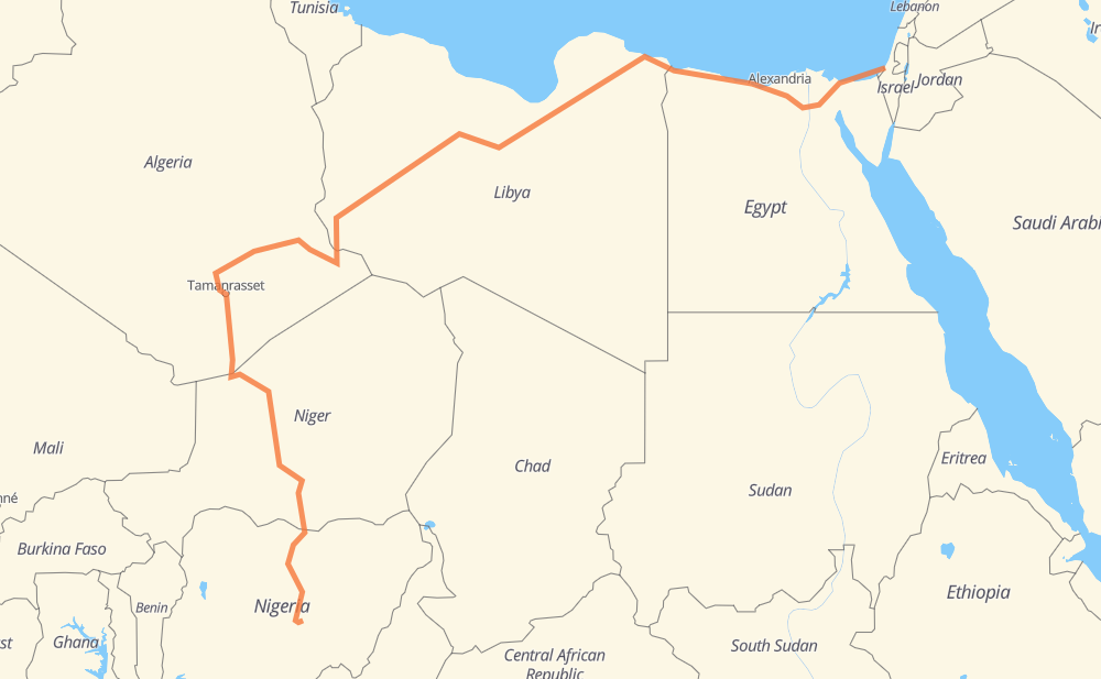
The distance from Yad Mordechay to Bina is 3,811 miles by road including 88 miles on motorways. Road takes approximately 77 hours and 53 minutes and goes through Al Arish, Al Ismailiya, Cairo, Sadat City, New Nubaria, Sidi Abdelrahman and Al Sellum.
You can adjust fuel consumption and fuel price here.
How long is a car ride from Yad Mordechay to Bina?
Driving time:
77 h 53 min
This time is calculated for driving at the maximum permitted speed, taking into account traffic rules restrictions.
71 mi with a maximum speed 68 mph = 1 h 2 min
1 mi with a maximum speed 62 mph = 1 min
1,310 mi with a maximum speed 56 mph = 23 h 23 min
23 mi with a maximum speed 56 mph = 24 min
2,402 mi with a maximum speed 50 mph = 48 h 18 min
30 mi with a maximum speed 37 mph = 48 min
97 mi with a maximum speed 31 mph = 3 h 6 min
9 mi with a maximum speed 12 mph = 45 min
The calculated driving time does not take into account intermediate stops and traffic jams.
How far is Yad Mordechay to Bina by land?
The distance between Yad Mordechay and Bina is 3,811.5 mi by road including 87.6 mi on motorways.
Precise satellite coordinates of highways were used for this calculation. The start and finish points are the centers of Yad Mordechay and Bina respectively.
How far is Yad Mordechay to Bina by plane?
The shortest distance (air line, as the crow flies) between Yad Mordechay and Bina is 2,269.9 mi.
This distance is calculated using the Haversine formula as a great-circle distance between two points on the surface of a sphere. The start and finish points are the centers of Yad Mordechay and Bina respectively. Actual distance between airports may be different.
How many hours is Yad Mordechay from Bina by plane?
Boeing 737 airliner needs 4 h 33 min to cover the distance of 2,270 mi at a cruising speed of 497 mph.
Small plane "Cessna 172" needs 16 h 36 min to flight this distance at average speed of 136 mph.
This time is approximate and do not take into account takeoff and landing times, airport location and other real world factors.
How long is a helicopter ride from Yad Mordechay to Bina?
Fast helicopter "Eurocopter AS350" or "Hughes OH-6 Cayuse" need 15 h 13 min to cover the distance of 2,270 mi at a cruising speed of 149 mph.
Popular "Robinson R44" needs 17 h 23 min to flight this distance at average speed of 130 mph.
This time is approximate and do not take into account takeoff and landing times, aerodrome location and other real world factors.
What city is halfway between Yad Mordechay and Bina?
The halfway point between Yad Mordechay and Bina is Al Awaynat. It is located about 64 mi from the exact midpoint by road.
The distance from Al Awaynat to Yad Mordechay is 1,842 mi and driving will take about 34 h 37 min. The road between Al Awaynat and Bina has length 1,970 mi and will take approximately 43 h 15 min.